
Overview
Colca Canyon from Arequipa to Puno is the one-way version of the valley trip, designed for travellers heading east instead of doubling back. The tour picks up in Arequipa on the first morning and drops off in Puno on the second afternoon, with luggage carried the whole way.
The first stretch climbs out of Arequipa through the Salinas y Aguada Blanca National Reserve, home to vicuñas and flocks of Andean geese. Misti at 5,822 m and Chachani at 6,057 m dominate the view behind the bus for the first hour.
Patapampa, at 4,910 m, is the highest point of the day. Eight volcanoes are visible from the platform, Ampato and Sabancaya among them, and the ground is covered in apachetas, the stone stacks left by travellers as offerings.
Chivay, at 3,635 m, is where the first night is spent. The town sits at the head of the valley, and the La Calera thermal baths 3 km away run at close to 38 °C, a common stop before dinner.
Day two starts early. The road runs west along the north bank past Yanque, Maca and Pinchollo, flanked by pre-Inca terraces still farmed by Collagua and Cabana families whose embroidered hats differ from village to village.
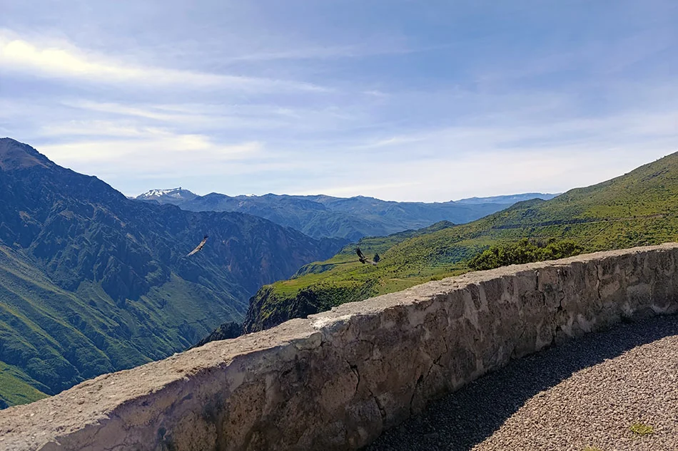
Cruz del Cóndor is the reason for the early start. The canyon reaches 3,270 m in depth here, and Andean condors with wingspans of up to 3.2 m ride the thermals along the rim, most reliably between 8:00 and 10:00.
From the viewpoint the route turns back through Chivay and heads northeast across open puna toward Imata and Santa Lucía. This is empty, wind-scoured country above 4,000 m, dotted with alpaca herds and shallow lagoons where flamingos feed.
The descent into Juliaca and then Puno takes the afternoon, covering roughly 300 km from Chivay. Arrival is usually between 17:00 and 18:00, in time to continue the next day to Uros, Taquile, Amantani or the homestay communities of Llachon and Luquina.